Weekend at the Great Smokies: Exploring the Wonders of America's Most Visited National Park
Embark on a solo adventure through the Great Smoky Mountains! Explore breathtaking landscapes, meet fellow travelers, and savor the essence of the journey.
I moved to North Carolina in February of this year, so this is my first time experiencing fall in the Carolinas. As winter approaches, I keep seeing Instagram reels showcasing the beautiful foliage from the Blue Ridge Parkway to the Great Smoky Mountains National Park. After checking the foliage map, I realized that this upcoming and next weekend would essentially be my last chance to witness the foliage before it goes past its peak. I found out about this on a Tuesday, but luckily, I've become so adept at trip planning that I put together a spontaneous weekend itinerary overnight. I'd love to share what I did that weekend to explore this wonderful park and create so many beautiful memories.
The Planning
My favorite way to plan trips is to watch travel vloggers on YouTube, explore their journeys, find things that interest me, and then plug those interest points into Google Maps. In the end, you should get some idea of the surrounding areas and learn enough about the map of that location to devise an itinerary in your head, ready for the time you've allocated.
One of my favorite YouTubers is Through My Lens, who does a great job walking through different destinations. He's a big inspiration for me to start this blog as well. Here’s the video that I watched for those of you who are interested:
Great Smoky Mountains Travel Guide: 2 Days Exploring the National Park by Through My Lens on YouTube
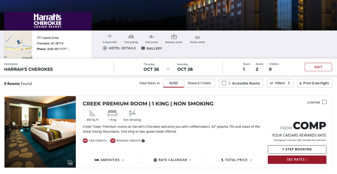
I am a fan of camping but only for a night or two; I just can’t get over not being able to shower for more than two days. As I searched on Google Maps for accommodations nearby, I discovered a Caesars casino near the park - and being a Caesars Rewards member, I often get comp nights at their properties. So I went on Caesar Entertainment’s website and checked - and what do you know, I get comp nights but only for Monday to Friday! No big deal! Since I would love to camp for a night as well, I will take these two comp nights as an absolute w.
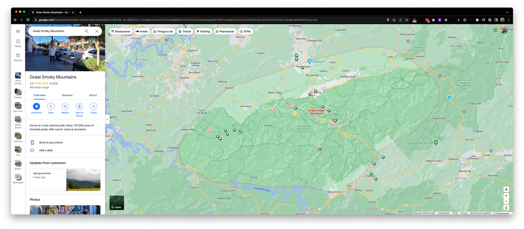
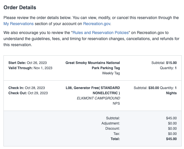
Then I went on recreation.gov to find campgrounds nearby. Out of the many, Elkmont Campground caught my eye. On the map, it looks like it’s sandwiched right between Gatlinburg, an interesting town with a few points on the map, and Cades Cove - another location that I would like to visit. At 30 dollars a night, this looks like a wonderful option to stay for my last night. So I booked it along with a weekly parking tag for the Great Smoky Mountains National Park.
Alternatively, you may also purchase a physical tag at one of these kiosks located in the park:
In-person sales locations:
- Gatlinburg Welcome Center - 1011 Banner Road, Gatlinburg, TN 37738
- Sugarlands Visitor Center - 1420 Fighting Creek Gap Road, Gatlinburg, TN 37738
- Greenbrier Grocery - 2406 E. Parkway, Gatlinburg, TN 37738
- Townsend Visitor Center - 7606 E. Lamar Alexander Parkway, Townsend, TN 37882
- Cades Cove Visitor Center - 686 Cades Cove Loop Road, Townsend, TN 37882
- Great Smoky Mountains Institute at Tremont Store - 9275 Tremont Road, Townsend, TN 37882
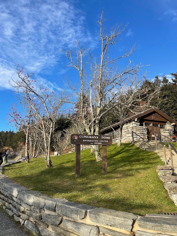
- Clingmans Dome Visitor Center - 7078 Clingmans Dome Road, Cherokee, NC 28719
- Oconaluftee Visitor Center - 1194 Newfound Gap Highway, Cherokee, NC 28719
- Swain County Visitor Center - 2 Everett Street, Bryson City, NC 28713
- Visit NC Smokies Visitor Center - 91 North Lakeshore Drive, Lake Junaluska, NC 28745
With those accommodations booked and all those dots on the maps - I headed out to pack and prepare my car for the weekend.
The Adventure
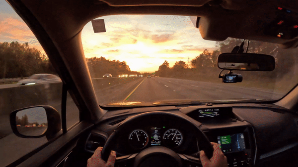
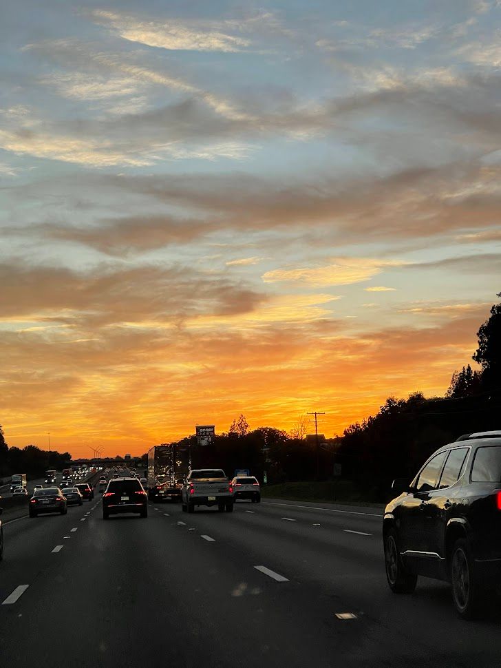
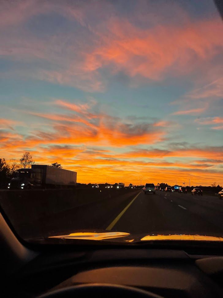
I left Raleigh with a burst of excitement right after wrapping up work on Thursday. On the way, I stumbled upon a Hawaiian spot near Greensboro, and given that I hadn't had Hawaiian food since I moved earlier this year, it was a no-brainer for my dinner stop. The sunset during my drive was nothing short of spectacular.
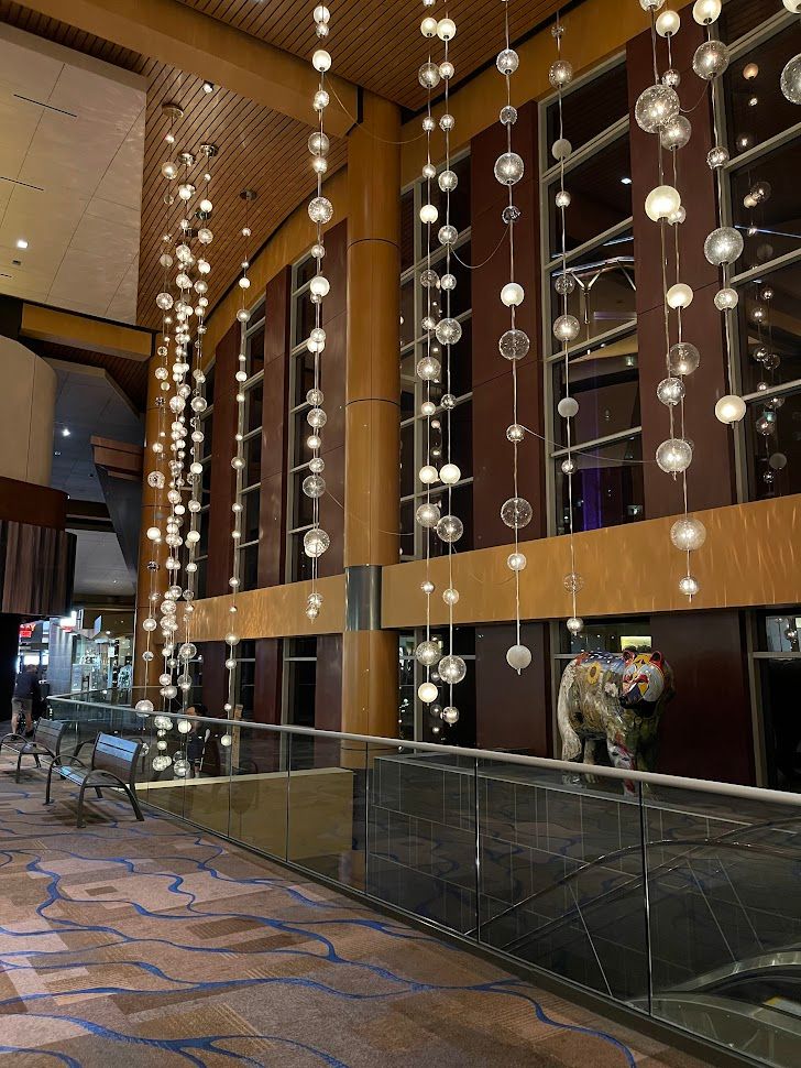
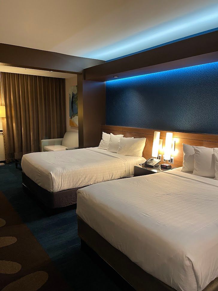
After about 5 hours on the road, with a satisfying dinner and a few pit stops sprinkled in, I rolled into Harrah’s Cherokee Casino Resort half an hour before midnight. The hotel parking lot was buzzing, but I eventually found a spot after a bit of a hunt. Check-in was a breeze, and with the weariness of the day melting away, I sank into the comfort of my room's tidy surroundings, drifting into a peaceful sleep.
Oconaluftee Visitor Center
As I wrapped up work tasks the next day in the afternoon, I was all set to get my first taste of the park. I kicked off my exploration at the Oconaluftee Visitor Center, conveniently close to where I was staying. The park rangers there were not only welcoming but also a goldmine of information about the park. I told them it was my first time, and they hooked me up with a map and some great suggestions for places to check out.
One thing I always love about visitor centers is the collection of stickers and magnets. It's a tradition I started during my cross-country road trip from California. Of course, I couldn't resist grabbing my National Park Service stamps for my Passport as well.
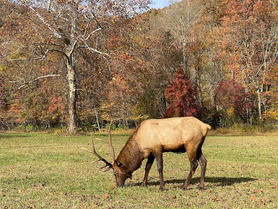
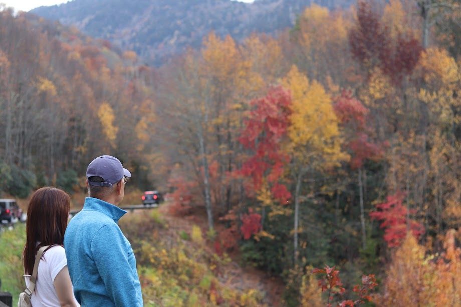
Leaving the visitor center, traffic into the park began to crawl. Turns out, there were herds of elk enjoying a leisurely snack in the grass fields, causing a bit of a roadblock. I pulled over to the side to snap some close-up shots of these majestic creatures.
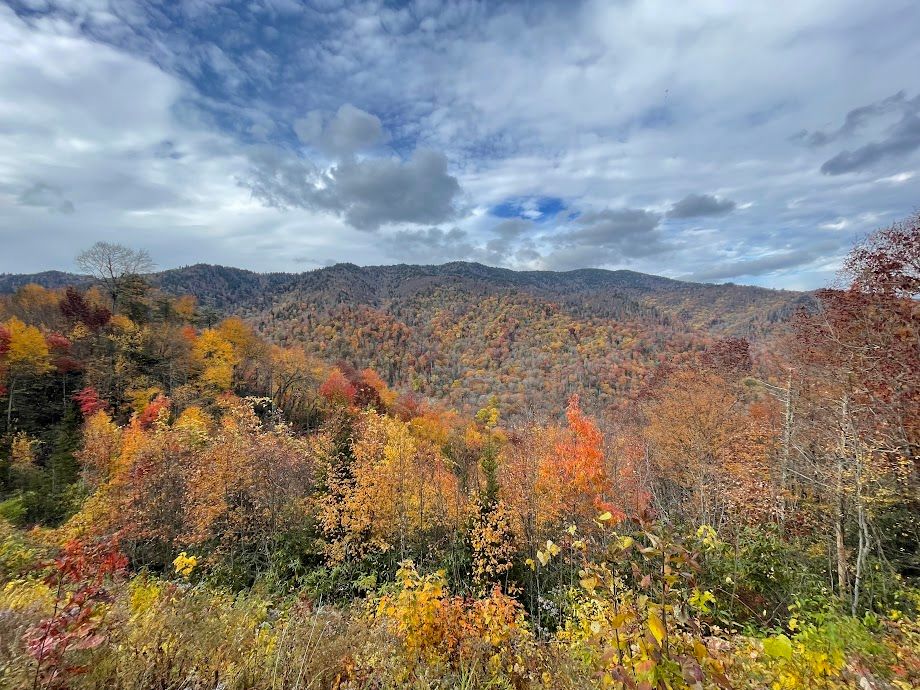
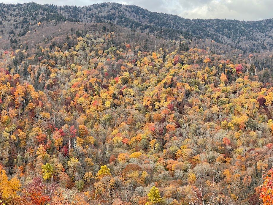
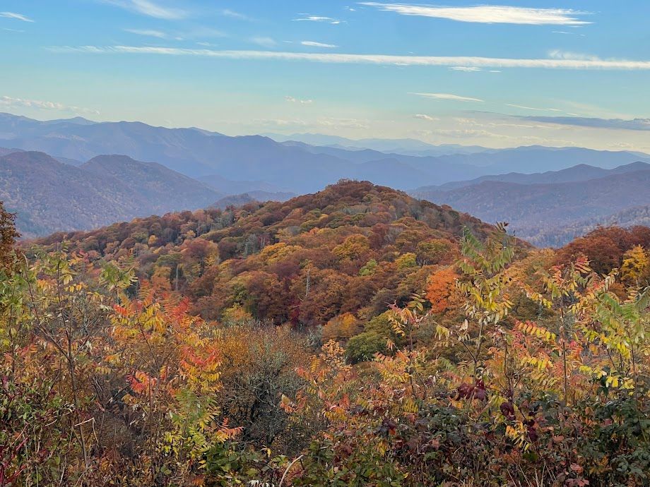
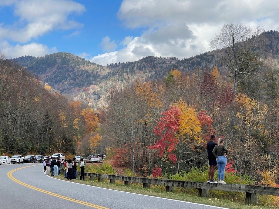
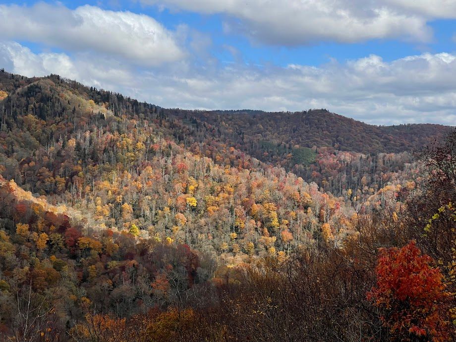
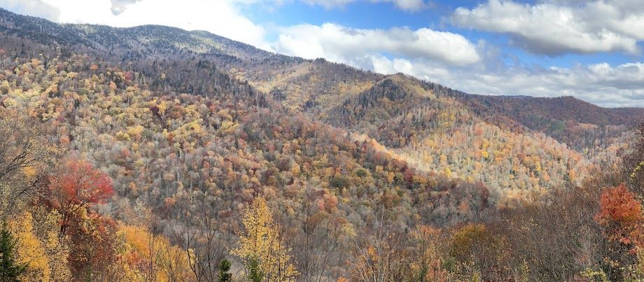
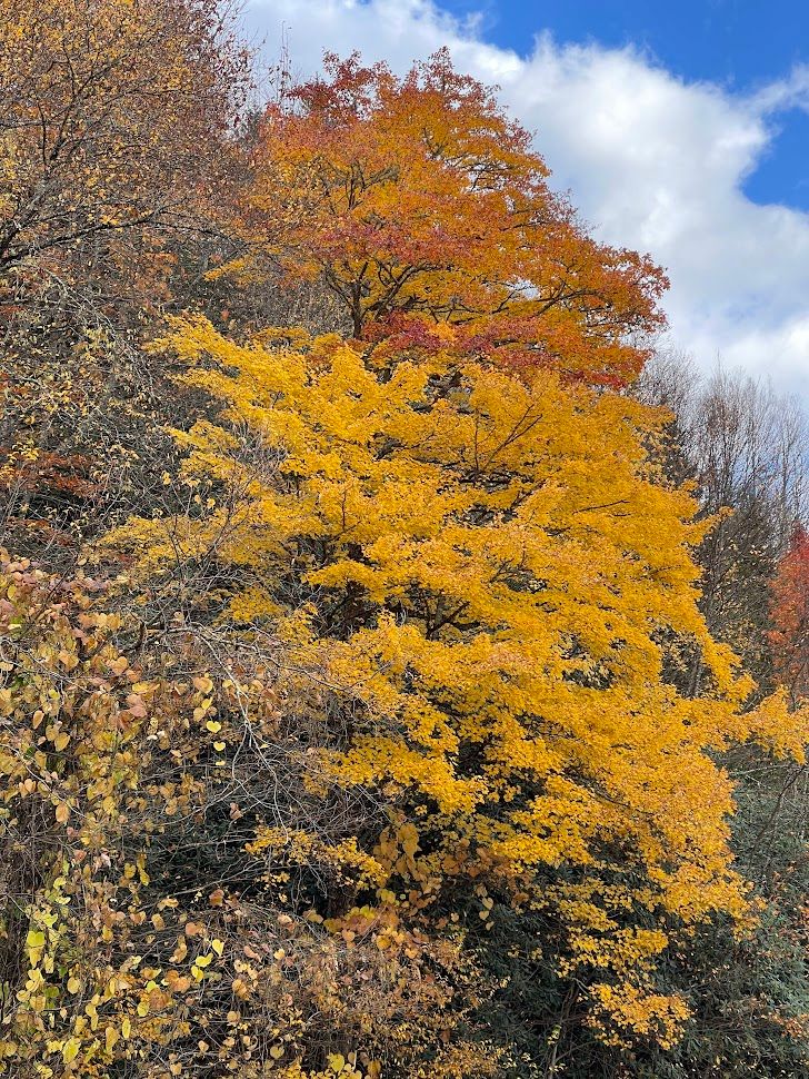
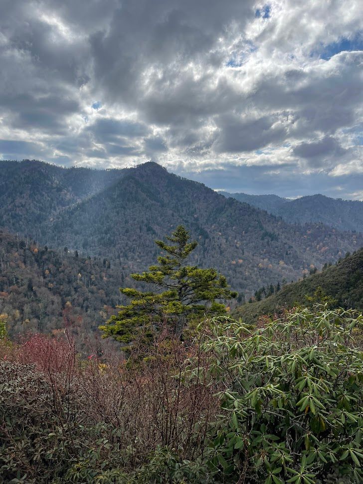
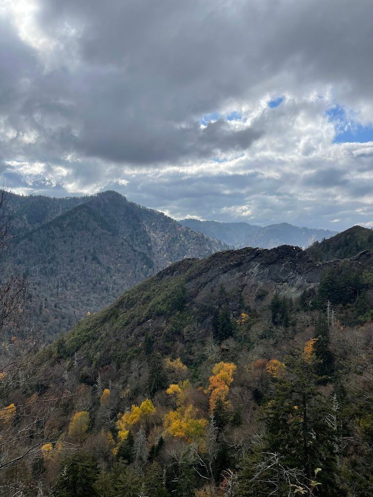
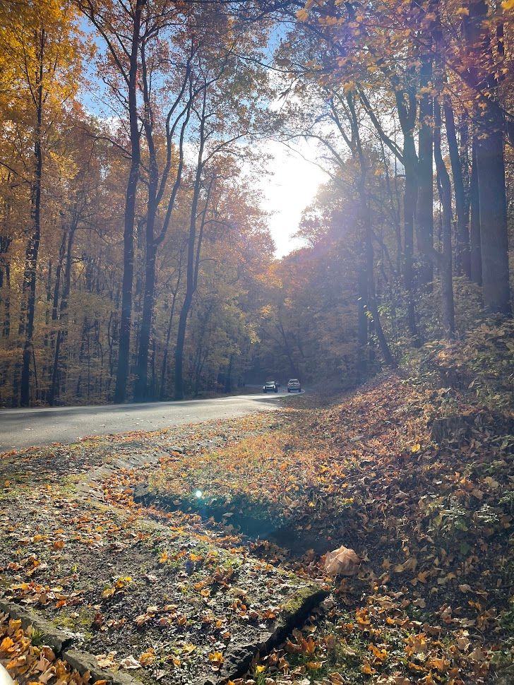
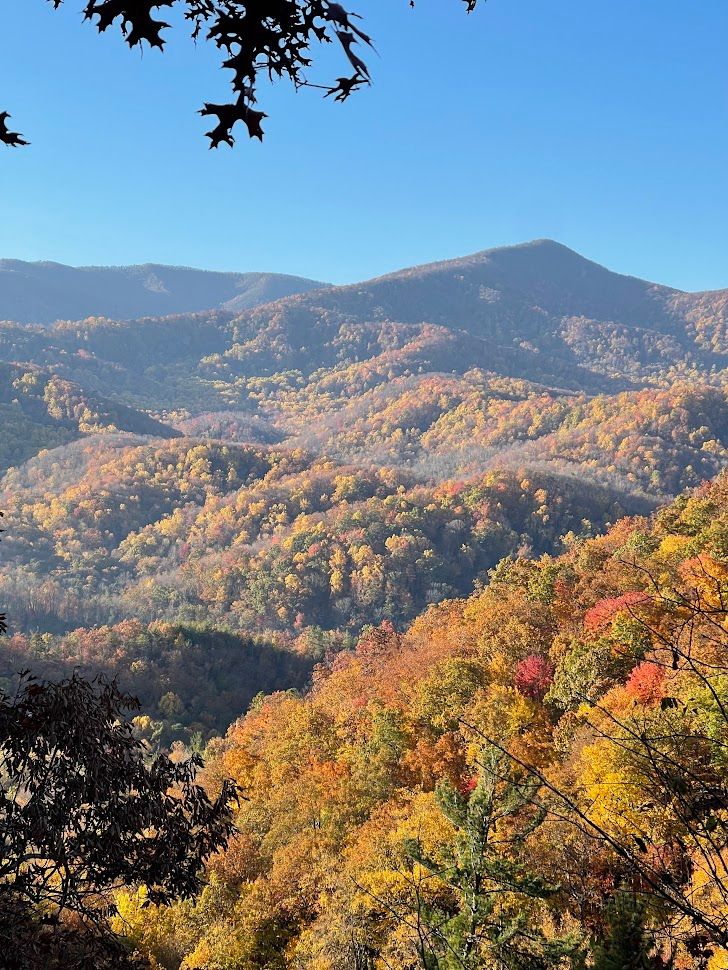
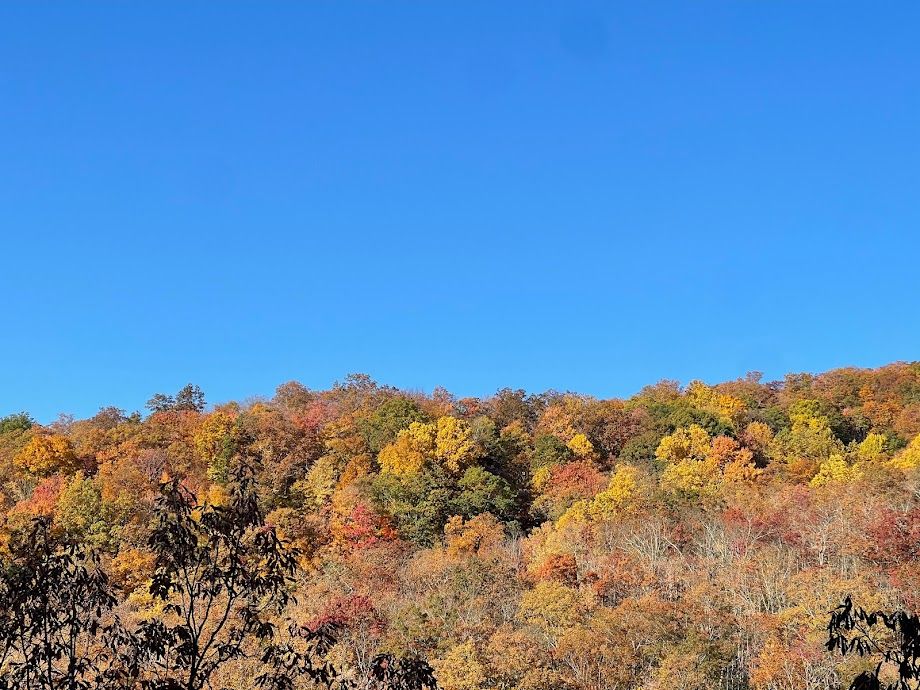
Overlooks
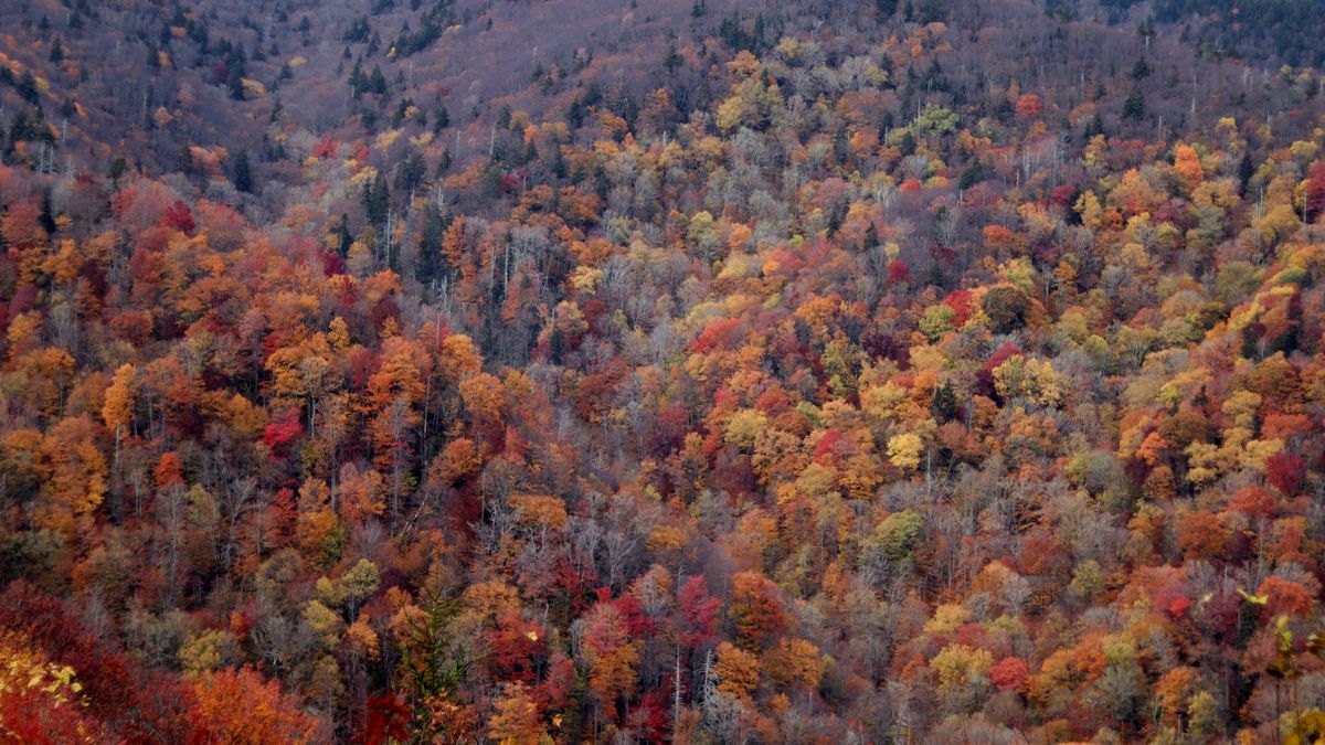
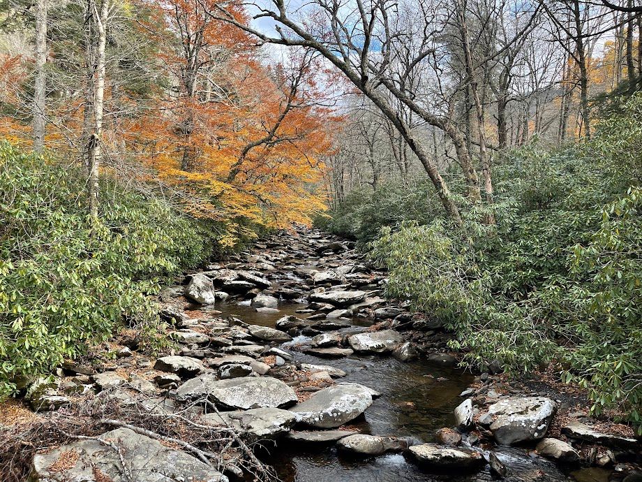
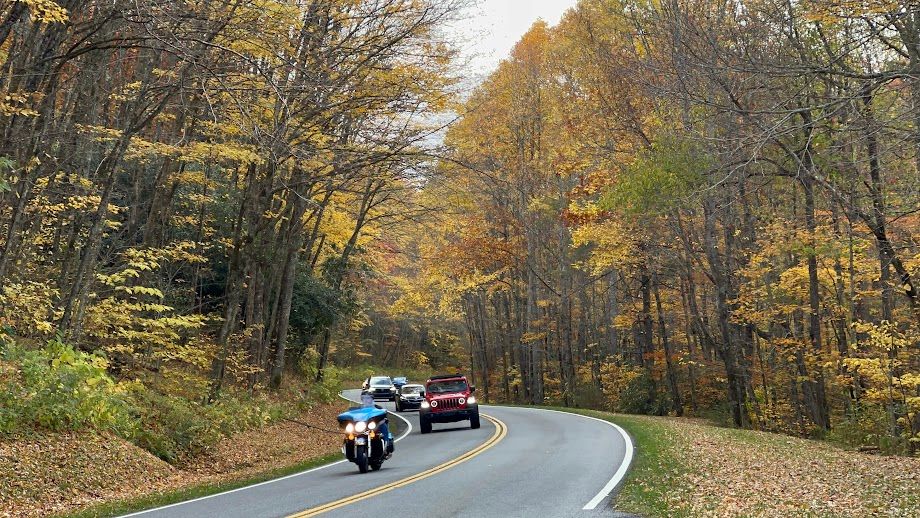
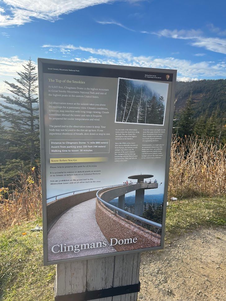
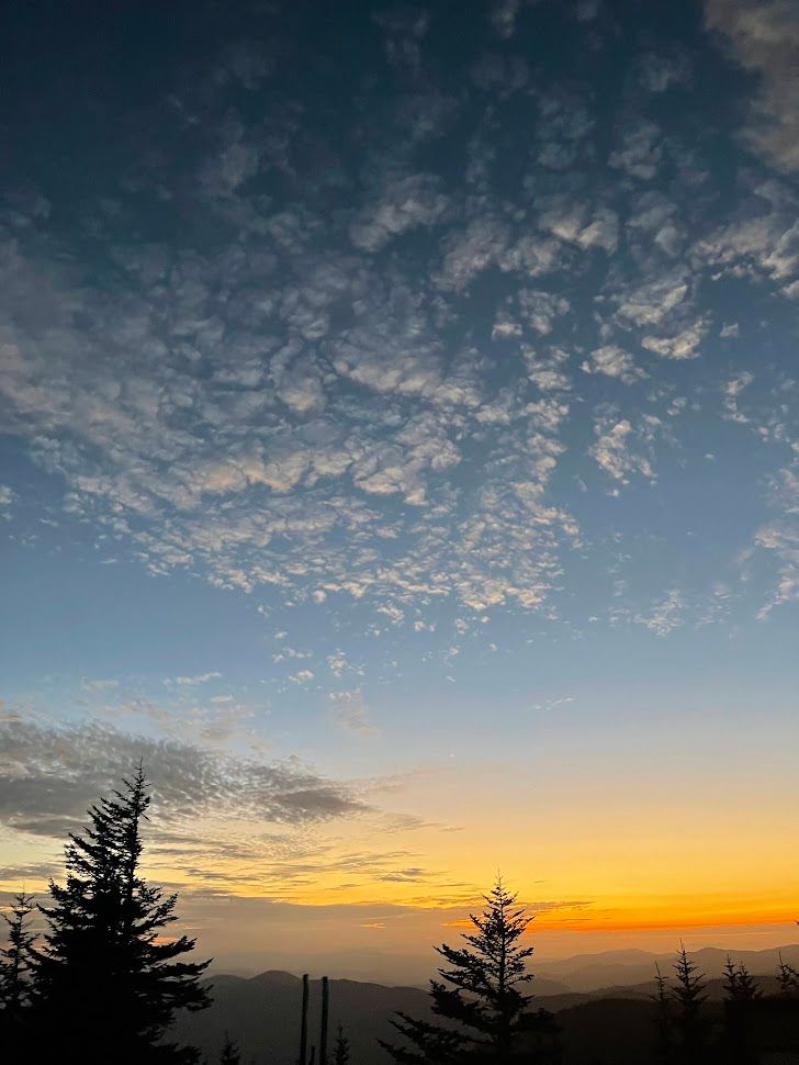
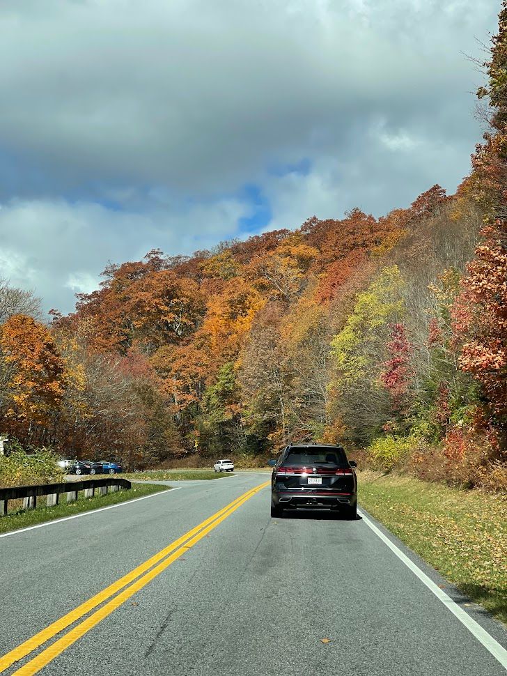
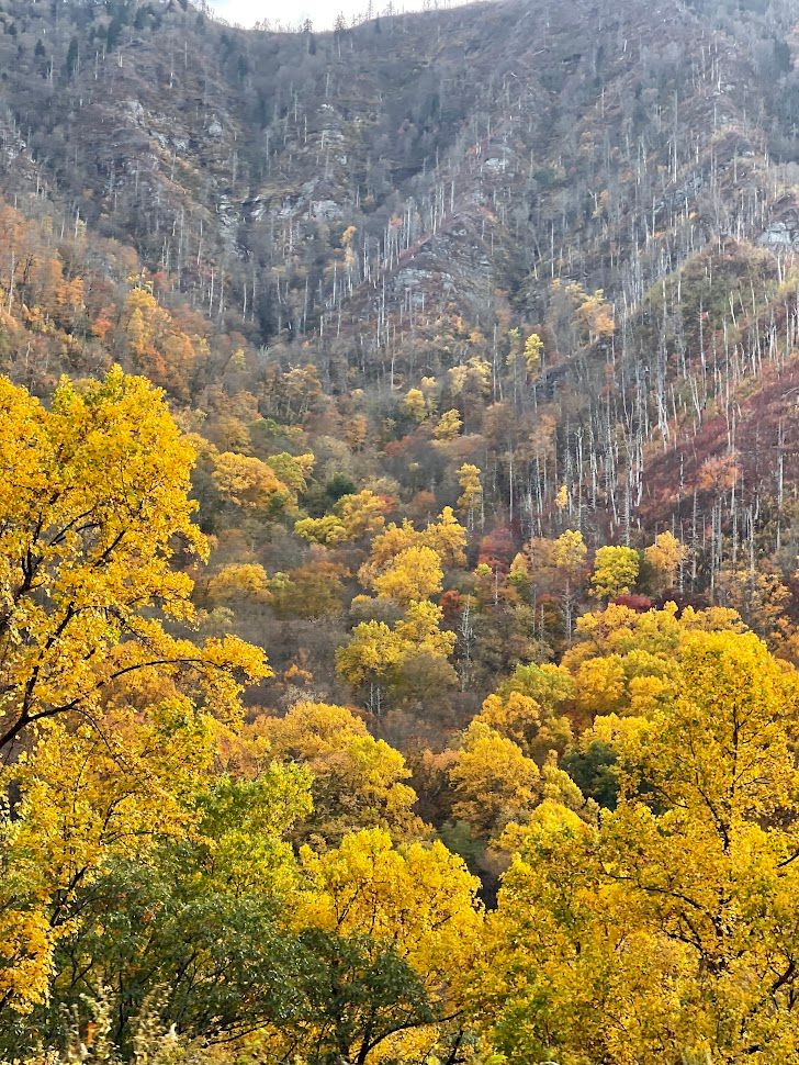
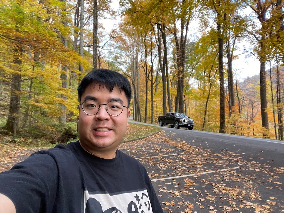
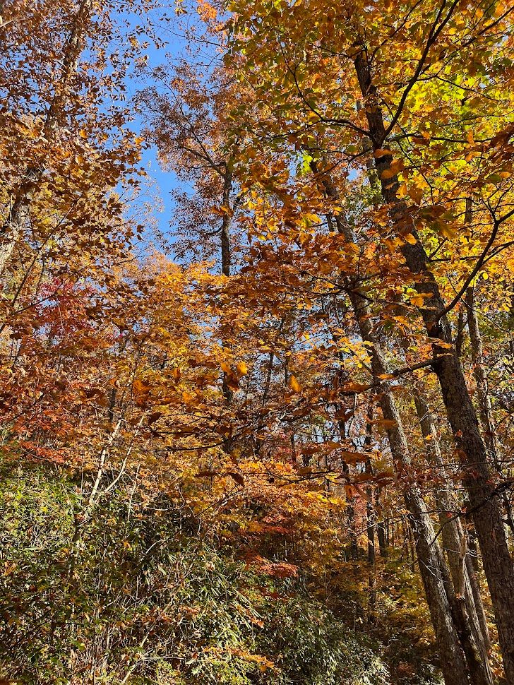
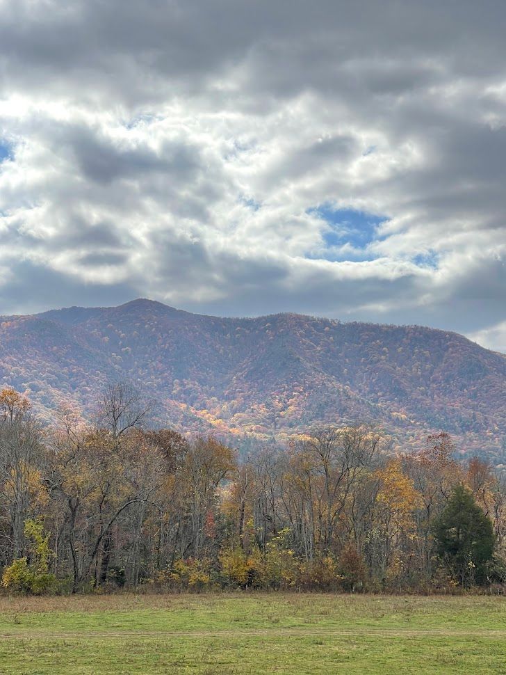
Having spent the last decade in the mild weather of the SF peninsula, the brilliant yellow foliage of fall amazed me at every turn. Every scenic pull-out was a temptation, and even though Clingmans Dome was only a 45-minute drive away, my frequent stops turned it into a 2-hour-and-30-minute adventure. But it was worth it; inhaling the crisp fall air, my eyes feasted on the vibrant autumn palette.

Clingmans Dome
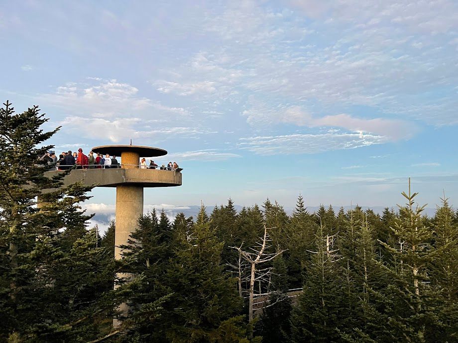
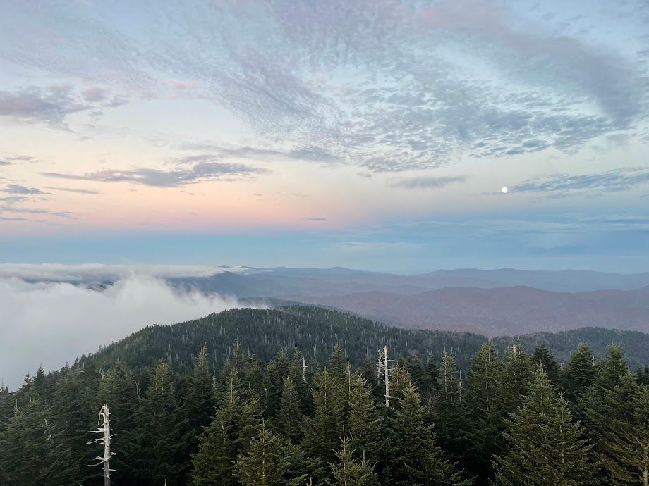
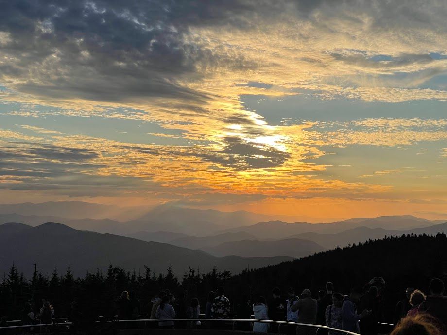
I finally reached the Clingmans Dome parking lot around 6 PM, just an hour before sunset, and without wasting any time, I started up the paved path.
Elevation: Standing at 6,643 feet (2,025 meters) above sea level, Clingmans Dome is the highest point in the Great Smoky Mountains National Park.
Rank Among Eastern U.S. Peaks: While it is the highest point in the Appalachian Mountains, Clingmans Dome is not the highest peak on the entire East Coast. That distinction goes to Mount Mitchell in North Carolina, which is part of the Black Mountains and stands at 6,684 feet (2,037 meters) above sea level. Therefore, Mount Mitchell holds the title of the highest peak in the eastern United States.
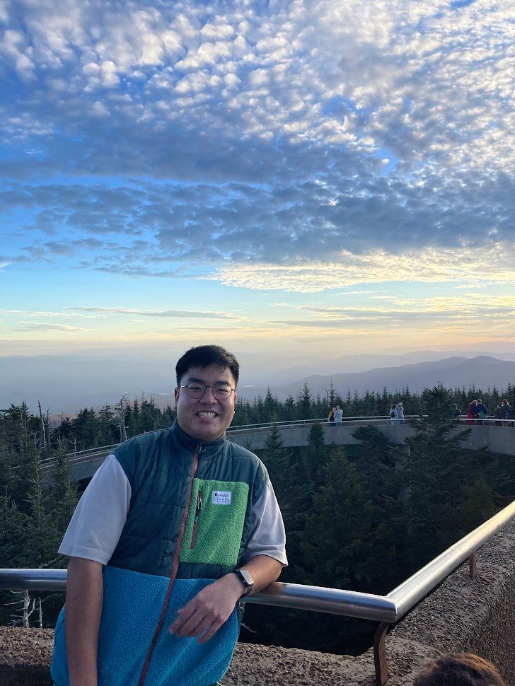
Observation Tower: The tall tower at the top gives you a full 360-degree view of the mountains and everything around.
Visitor Tips: It can be chilly up there, so bring something warm. The trail is a bit steep, but the view from the top is totally worth it. You can get there by walking a half-mile on a paved trail. The view from the top is amazing, especially during sunrise and sunset.
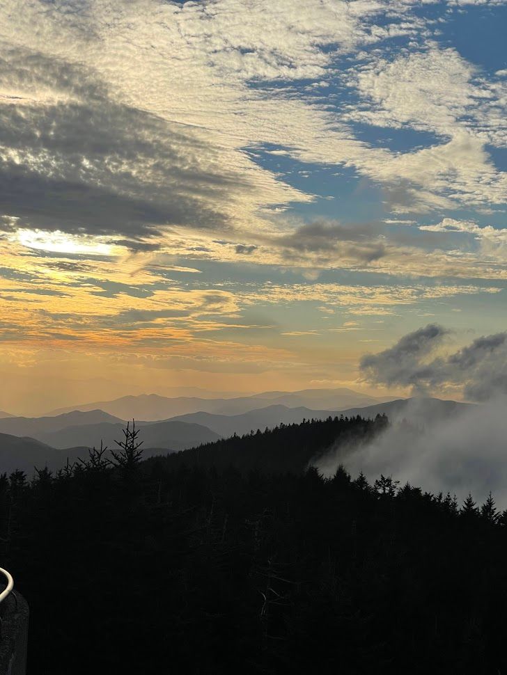
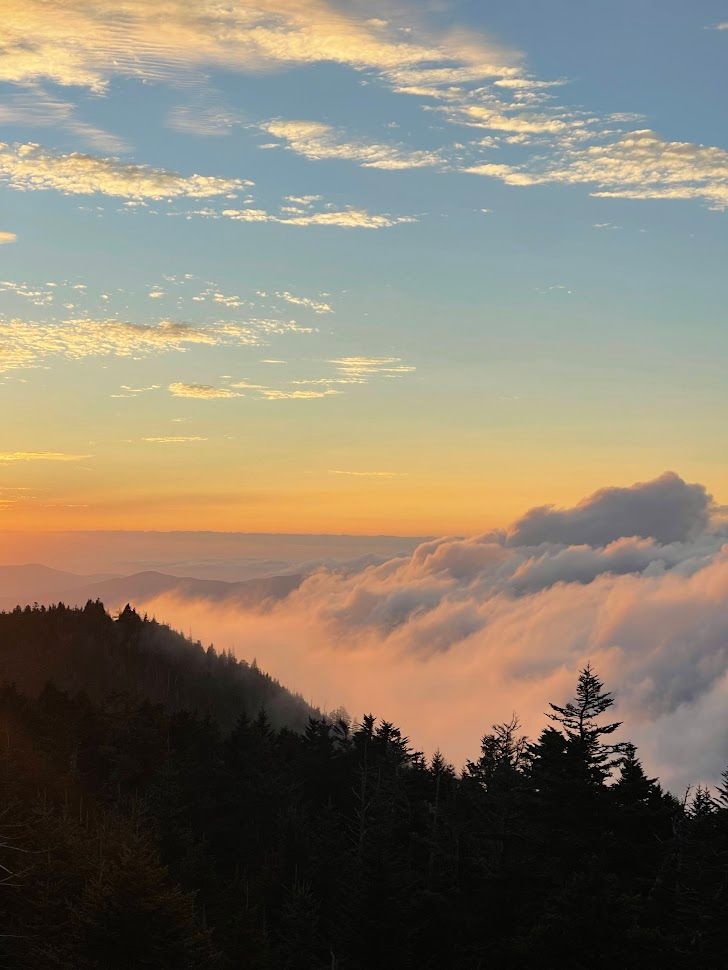
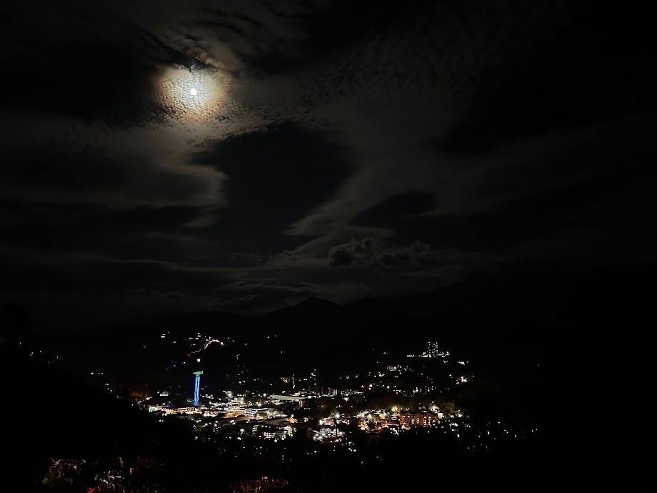
Despite the crowded conditions, the view from the top of the dome was truly breathtaking. On the Tennessee side, a mesmerizing scene unfolded as the sun dipped below the horizon, casting a warm orange glow on the rolling fog, transforming it into a sea of brightness with a delicate pink tint. On the Carolina side, where the mountains sprawled out in the distance, half-covered by the lingering fog, the combination of the pink hues and the deep blue sky above the peaks created a picture-perfect moment. As the evening progressed, the moon made its appearance on this side as well, adding a touch of magic to an already enchanting landscape.
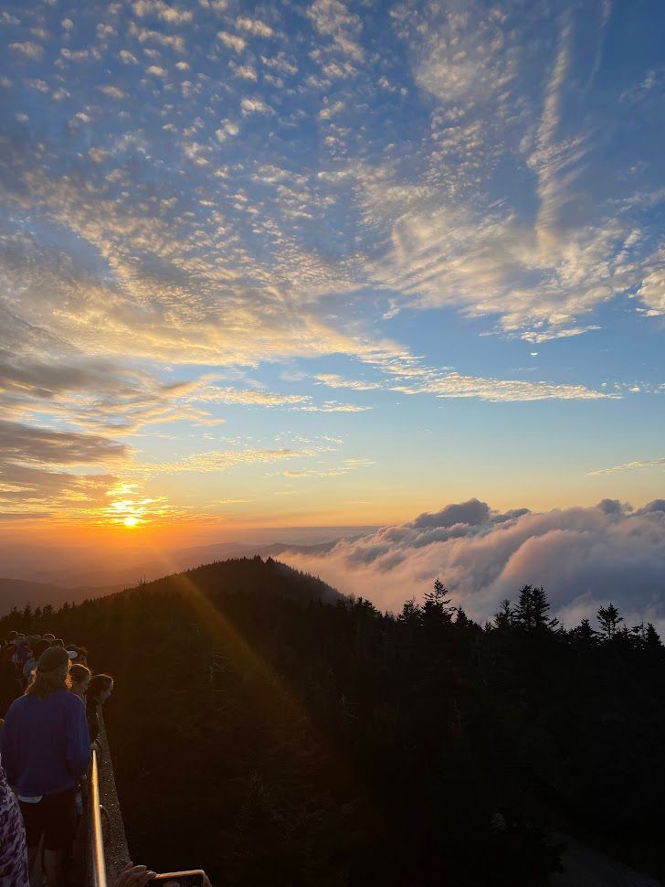
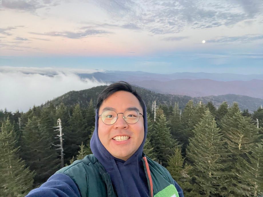
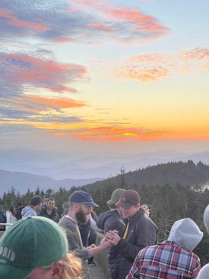
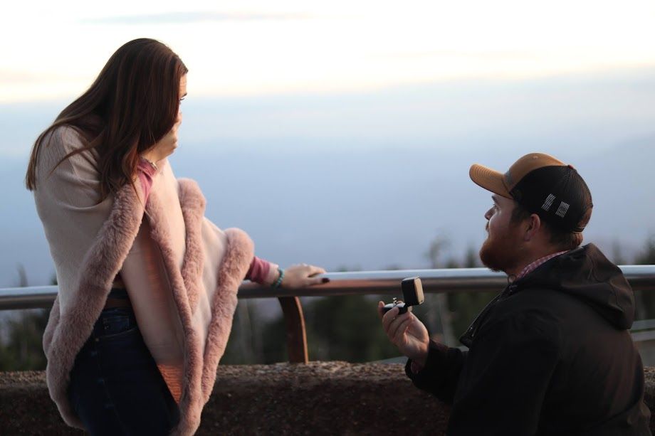
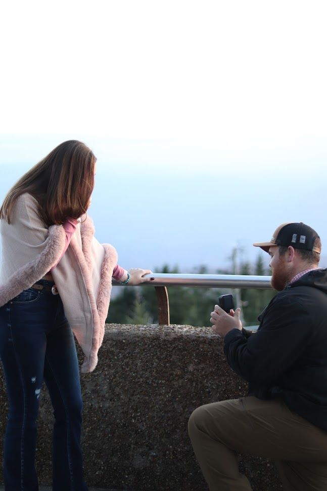
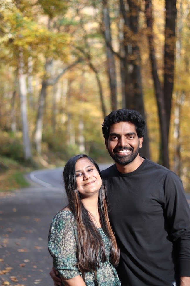
At the viewpoint, something heartwarming happened that added a special touch to my solo adventure. I noticed a guy, Jacob, lending a hand to strangers by taking great portraits for them with their phones. Being a solo traveler, I wanted to capture my own moment, so I mustered the courage to ask for his help. Jacob happily took a few shots for me, and we got to talking. Turns out, he was up there with his fiancée and their families.
Feeling grateful for his kindness, I offered to take some family photos for them during the beautiful golden hour. We all just hung out, enjoying the sunset together. Right as the sun disappeared, I spotted Jacob getting down on one knee, pulling out a ring, and proposing to his fiancée. Luckily, I had my DSLR camera with me, so I started snapping away, trying to capture this amazing moment. I'm no pro photographer, but I managed to get some shots that I really liked.
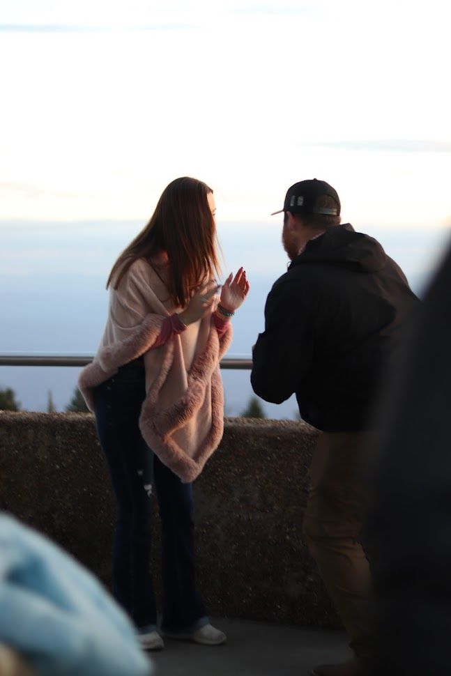

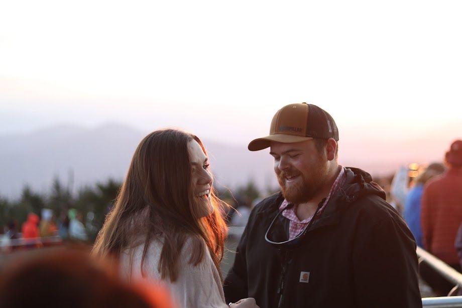
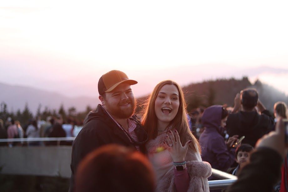
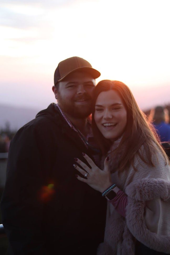
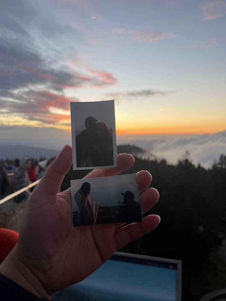
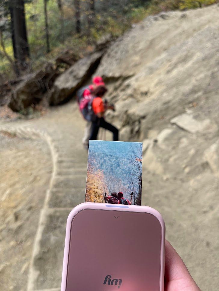
Later, I printed a couple of instant photos from my Canon Ivy 2 Mini Photo Printer and gave them to Jacob. We exchanged numbers so I could send them the digital copies. They loved the photos, and it turned out to be a truly unforgettable moment for me too.
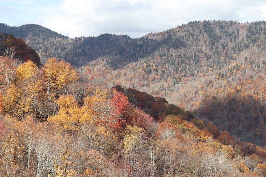
Overlooks (in the morning)
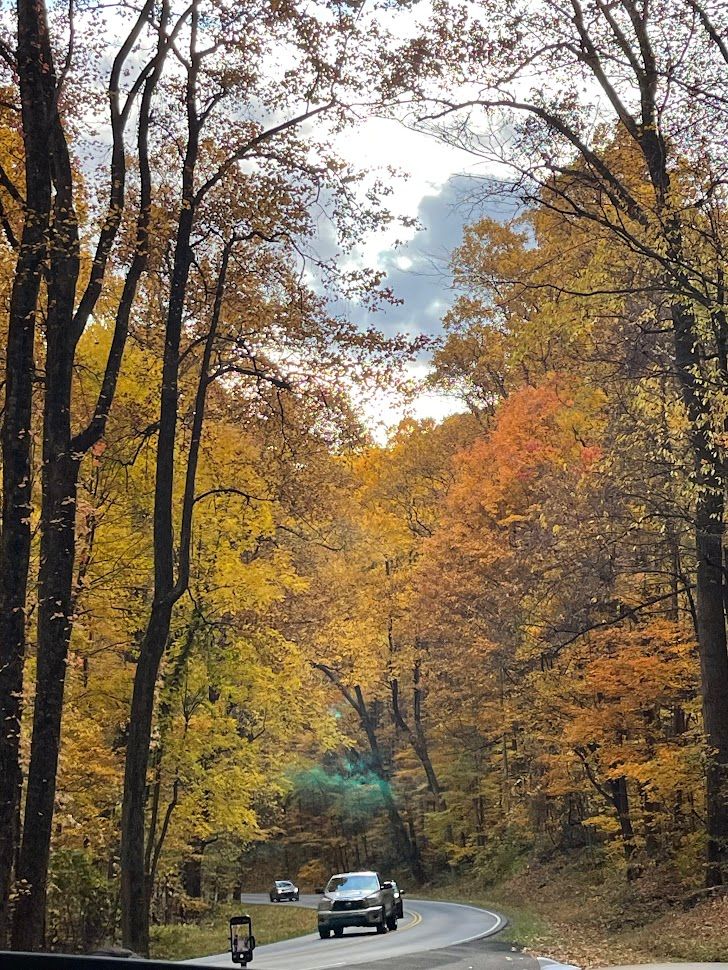
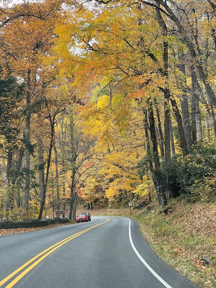
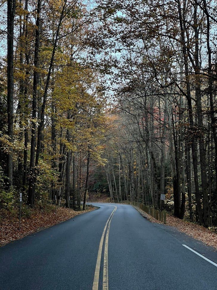
After dinner and a decent night's sleep, I got ready for the next day's adventures. I packed up my backpack, checked out of the hotel, grabbed a quick breakfast, and filled up on gas before heading back into the mountains. Before getting to the park, I couldn't resist stopping by the entrance sign to snap a pic with the morning light doing its thing. Once again, those scenic overlooks pulled me in with the morning sun giving a different vibe to the landscapes I enjoyed the day before. But I promise you all the detours were worth it, as I think for this national park and many others, the journey is the destination.
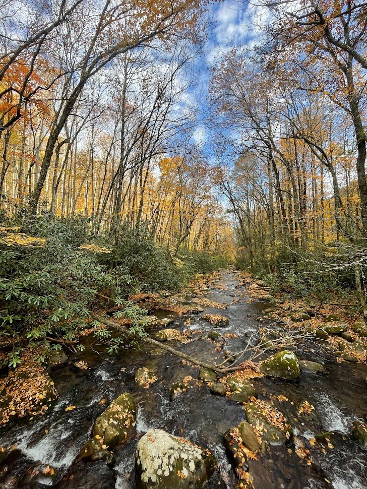
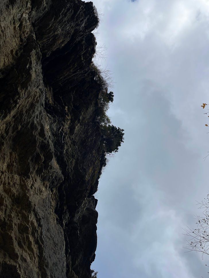
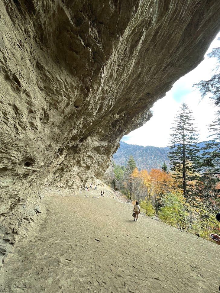
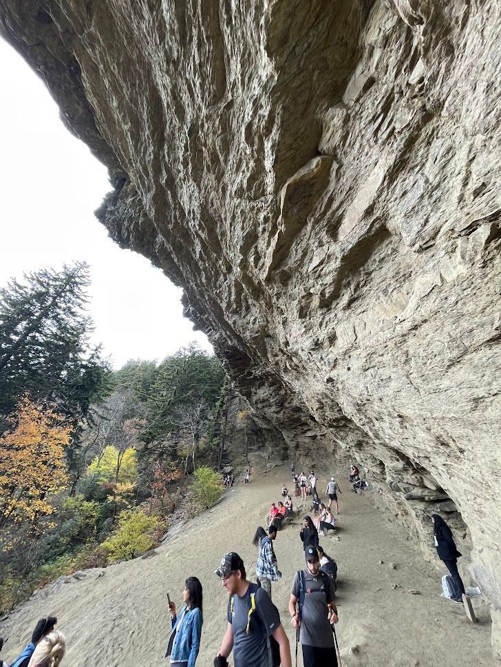
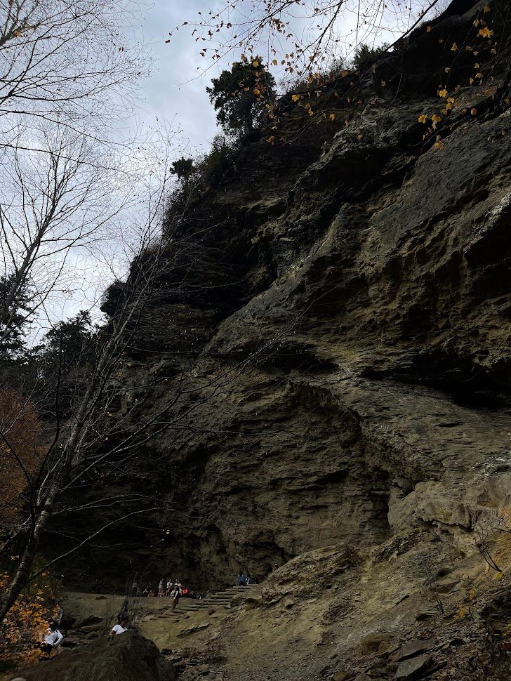
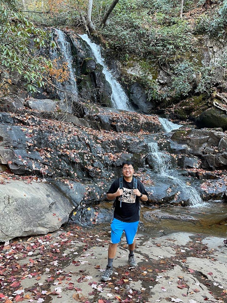
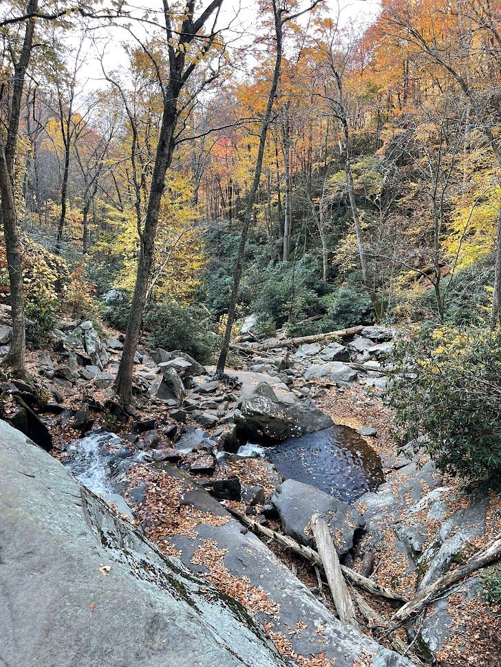
Alum Cave Trail
Getting to the Alum Cave trailhead around 1:30 pm, the parking lot was absolutely packed, so I had to drive about half a mile down the road to snag a parking spot. Found one, and off I went to the trailhead. The hike didn't seem too bad for me—2.3 miles to Alum Cave Bluff, with about 1100 feet of uphill, plus a cool stop at the arch rock halfway through.
Arch Rock
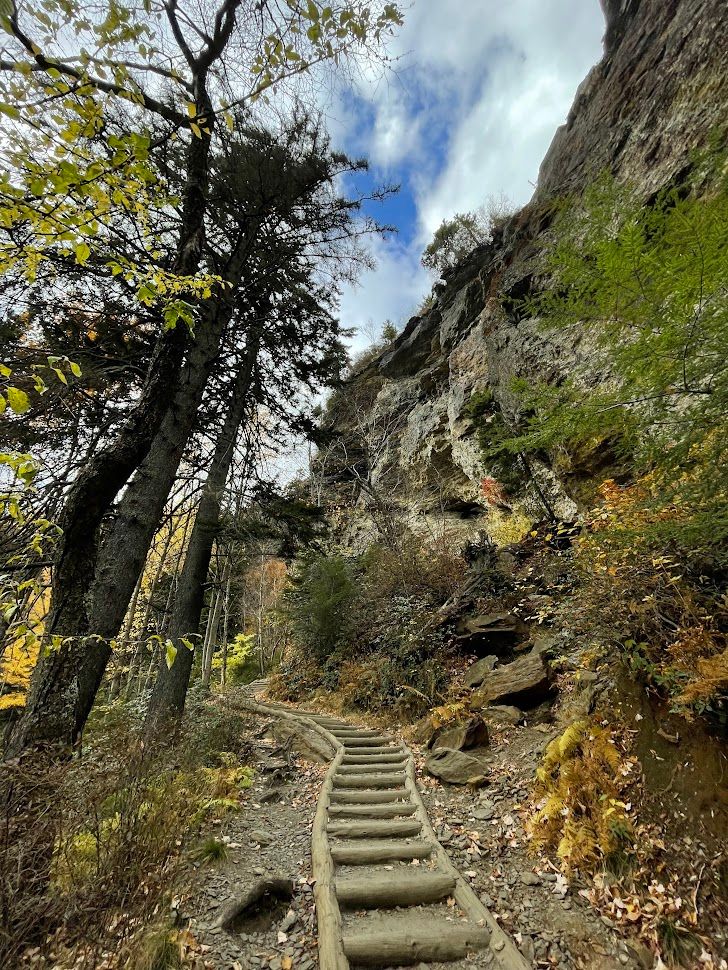
Alum Cave Trail
Alum Cave: It's not a cave!
Geological Formation: The trail features an outcrop of the Anakeesta rock formation, which is high in sulfur. This formation is responsible for the huge, leaning rock face of the Alum Cave Bluffs.
Not a Cave: Despite its name, Alum Cave Bluff is not a cave but a rock shelter. It’s a black slate that juts out in the form of a ledge, covering the trail and giving the impression of a cave.
Alum Deposits: The name of the formation comes from the deposits of alum found along the “cave” walls. Alum is a form of sulfur, and you can detect the odor of sulfur in the air when you reach the site.
Appearance: While it may resemble the opening of a cave, Alum Cave Bluff is more accurately described as a concave cliff or a rock shelter.
The Loop, Chimney Tops Overlook, and Elkmont Campground
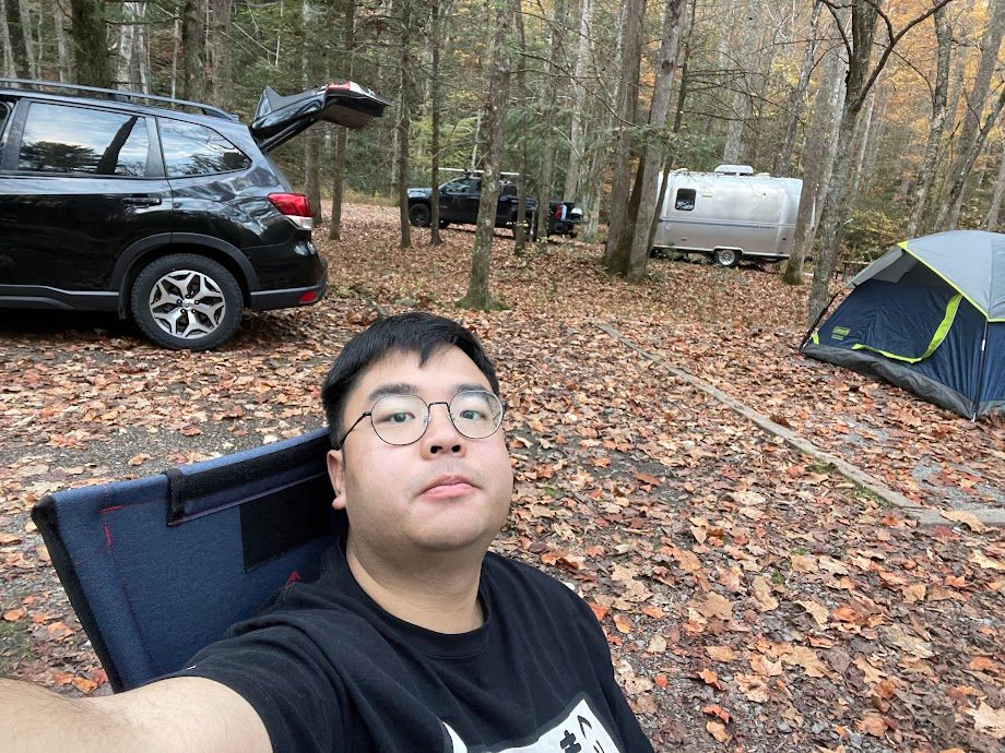
After checking out the cave, my next stop was Elkmont Campground to pitch my tent before sundown. On the way, I passed through a section known as The Loop, a scenic 360-degree spin on the park road. Right after that, I reached Chimney Tops Overlook, the golden hour sunlight painted the leaves in the most breathtaking golden yellow hues I had witnessed on the entire trip. It was a must-stop moment for some photos, and while capturing the beauty, I stumbled upon a couple taking selfies. I offered to take their portraits, making use of the sunlight and the golden leaves. Later, I found out it was their anniversary, and I was glad to help them freeze that moment in time.
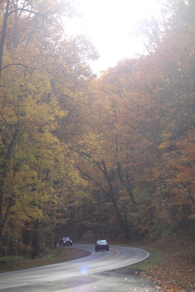
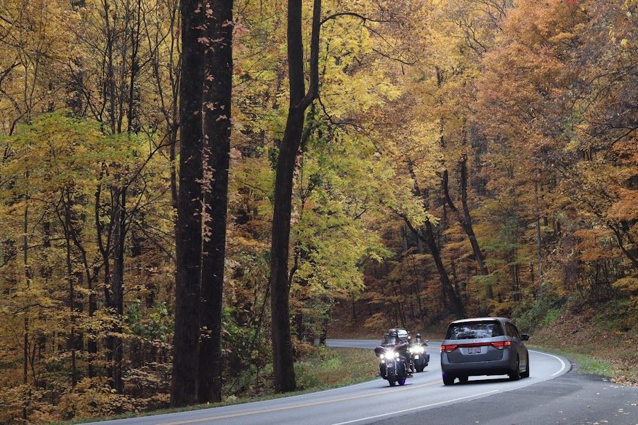
On the flip side, I encountered heavy traffic while turning into Fighting Creek Gap Rd from HWY 441. It seemed like everyone was making their way out eastward from various viewpoints and destinations within Flight Creek Gap Rd, likely heading into Gatlinburg or Pigeon Forge, the traffic spanned miles and miles. Fortunately, I wasn't the one stuck in that traffic mess, and it didn't seem like it was going to clear up any time soon before the sunlight bid its farewell.
traffic built up for miles on eastbound Flight Creek Gap Rd
But at last, I was able to set up my tent, took a bite of some snacks to get some energy back for my hikes, and took a quick nap to wait for the traffic to die down before I went out to the touristy town of Pigeon Forge for dinner.
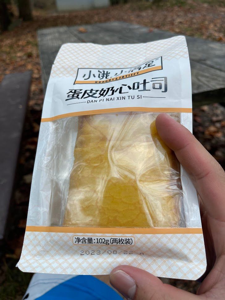


egg skin toast was meh, but the spicy beef jerky was fire af
The weather that night was pleasantly mild, allowing me to sleep comfortably in the tent. As a precaution, I had brought along an extra blanket and a heating pad, but it turned out I didn't need them. Learning from the traffic experience of the previous day, I was determined not to find myself stuck in a similar situation, especially on my last day. So, I woke up quite early around 8 am to ensure I could explore more attractions before leaving the park.
Laurel Falls
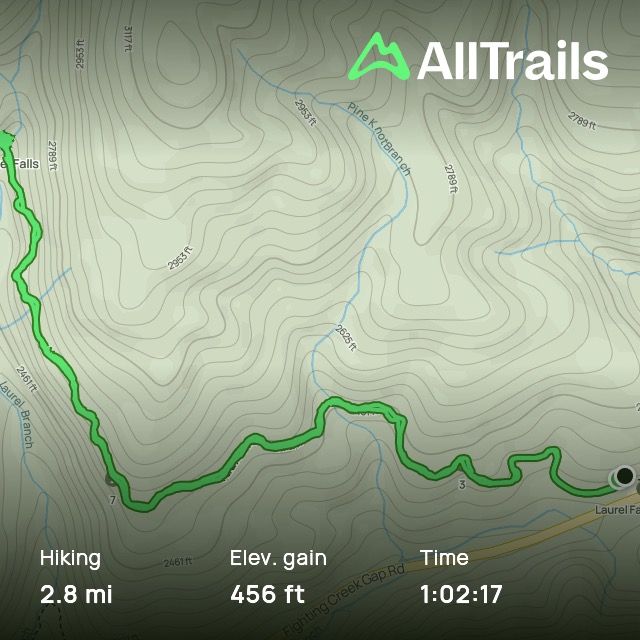
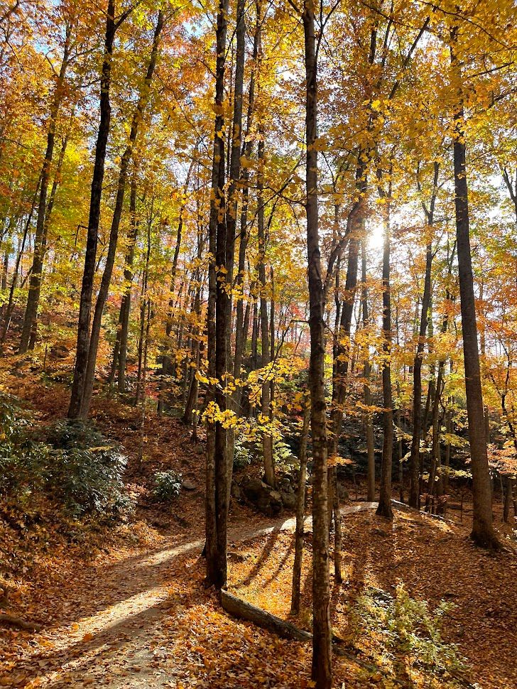
My first stop was Laurel Falls, a mere 6-minute drive from the campsite. Though it was autumn, and the water flow wasn't at its peak, the journey up the mountain was nothing short of breathtaking. Fall sunlight seemed almost like a magic wand, casting enchanting hues on everything it touched. I swear these fall sunbeams are paid actors, turning every scene into a display of vibrant and magical colors.
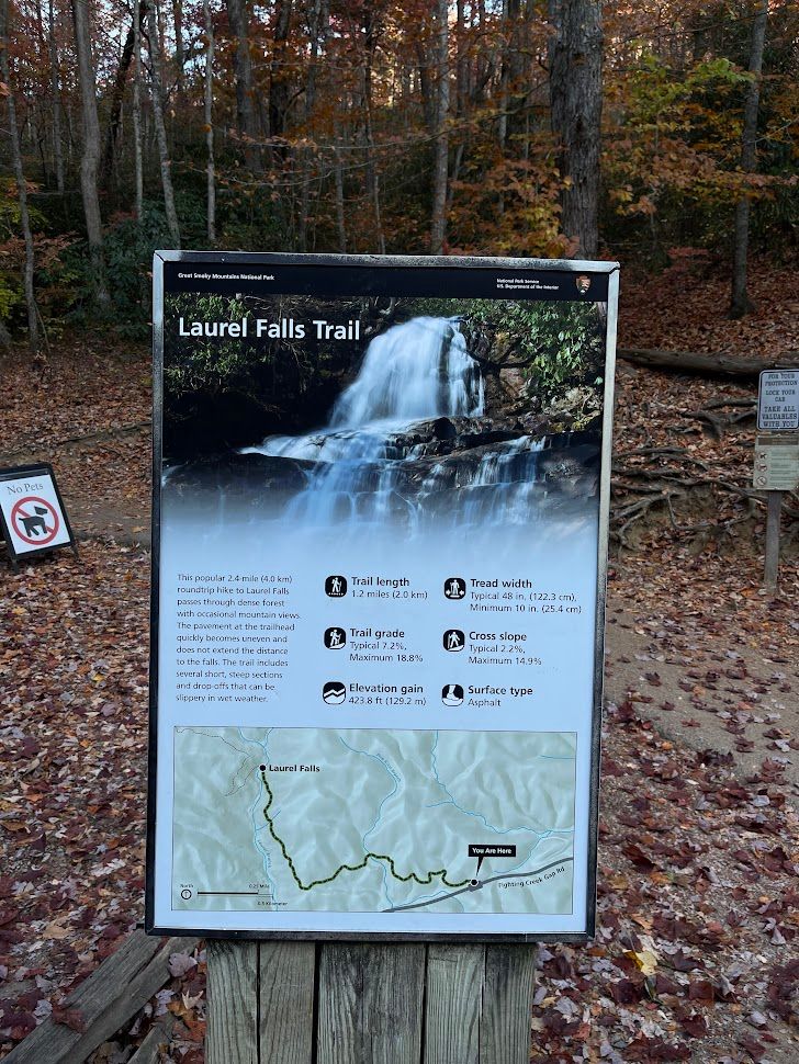

Laurel Falls
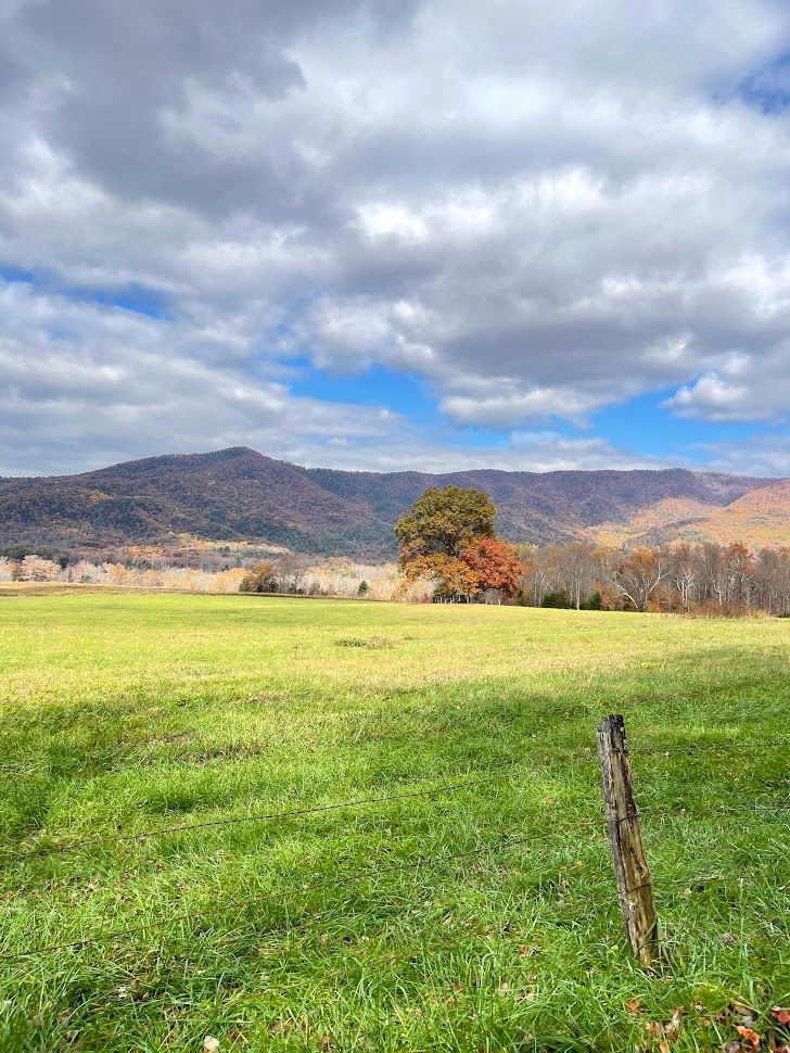
Cades Cove Scenic Loop
After reveling in the beauty of Laurel Falls, I set my sights on Cades Cove to explore its historic buildings along the scenic loop. Despite its popularity and warnings about heavy traffic, my determination to see it was unyielding. However, my enthusiasm waned as I encountered the gridlock, leading me to abandon the idea at the first turnout. Frustrated by the stagnant traffic, I realized that sometimes, travel plans don't unfold as expected. It's a part of the journey, and over the years of traveling, I've learned to navigate such hiccups. Instead of dwelling on the missed opportunity, I saw it as a reason to revisit this magnificent park, armed with better preparation and ample time to walk the 11-mile loop next time.
It offers a glimpse of Smoky Mountain history with its historic structures, gorgeous views, and wildlife.
The area was originally inhabited by Native American tribes, including the Cherokee and Creek.
European settlers arrived in the early 1820s, building log homes, barns, corncribs, smokehouses, and clearing land for farming.
Today, it’s one of the most visited areas in the Great Smoky Mountains National Park.
The area offers the widest variety of historic buildings of any area in the national park, including three churches, a working gristmill, barns, log houses, and other faithfully restored eighteenth- and nineteenth-century structures.
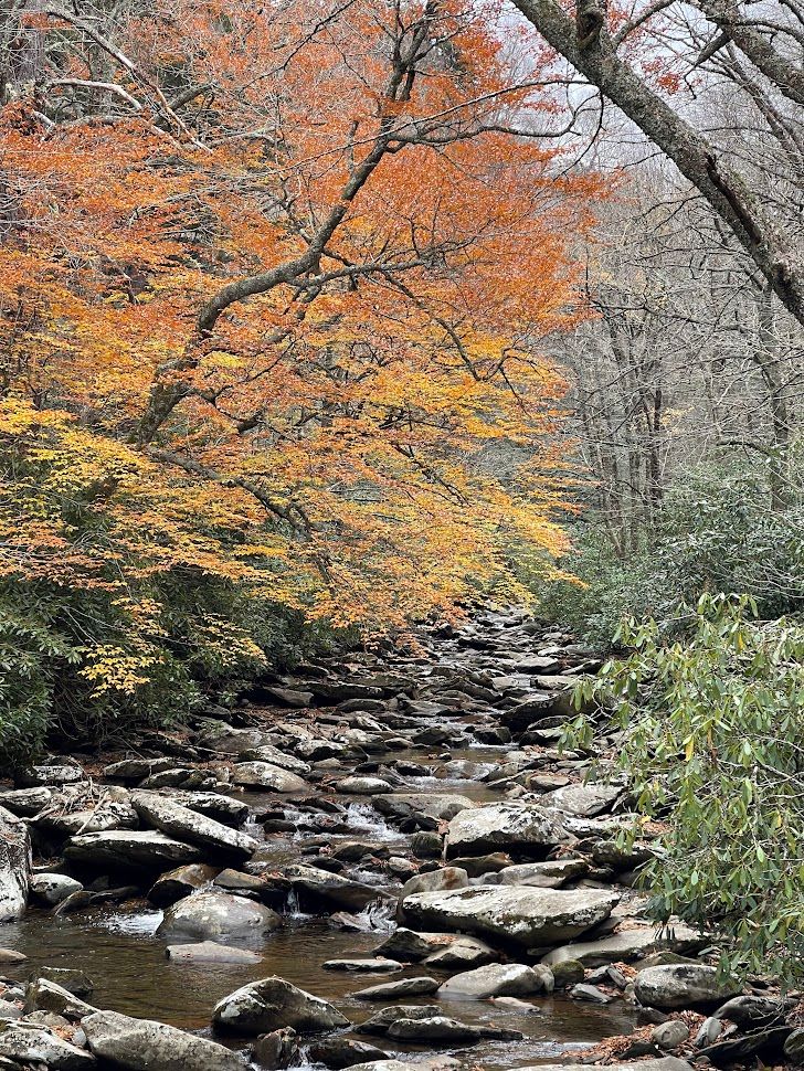
The Sinks
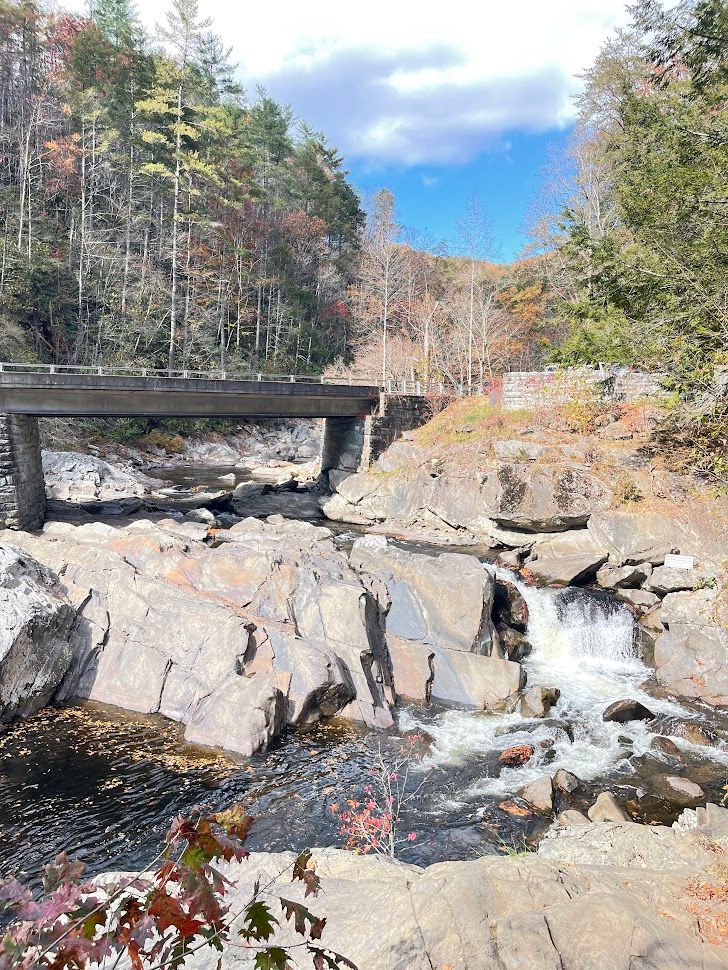
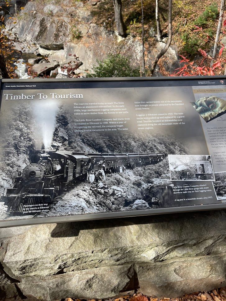
Escaping the traffic nightmare, I sought solace at The Sinks, capturing its beauty and reflecting on its historical significance. This small waterfall, born from loggers' dynamite, tells a tale of the logging industry's impact on the Great Smoky Mountains in the late 1800s. The explosion not only carved a 30-foot chasm but also altered the river's course, creating the unique landscape known as the Sinks.
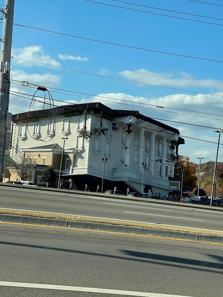
Pigeon Forge
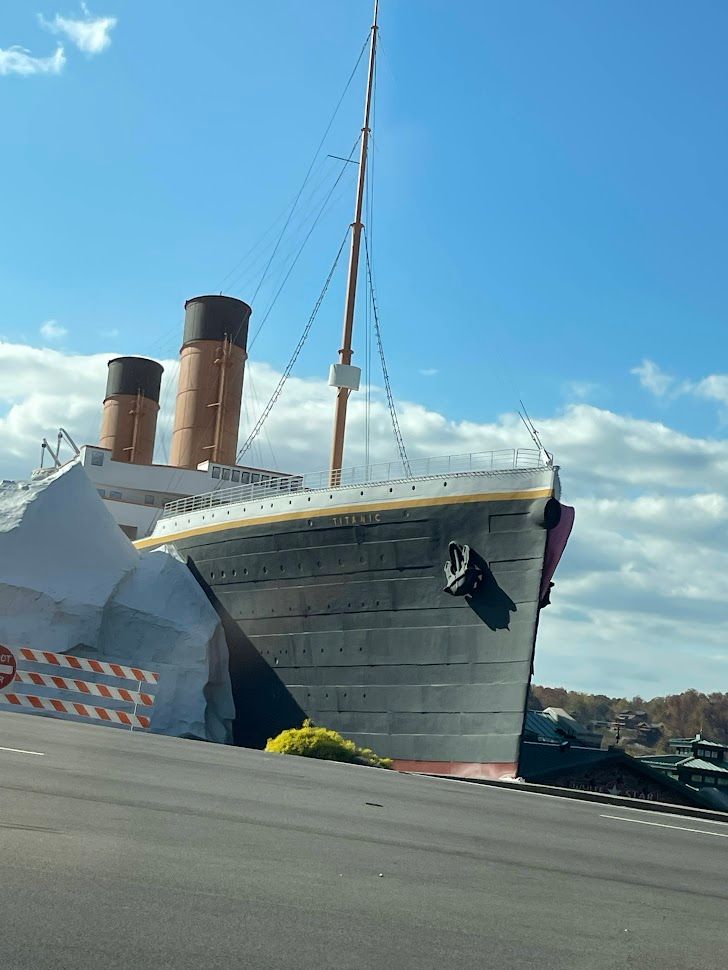
Heading back into Pigeon Forge, I had lunch and got the chance to marvel at the town's quirky structures. Pigeon Forge, it’s such a weird town for me because it has so many touristy things to do there as if it’s like the Las Vegas strip, but filled with fisherman's wharf activities. Such an interesting sight for me. But personally not a big fan of these attractions, so I just skimmed through and took some pictures.


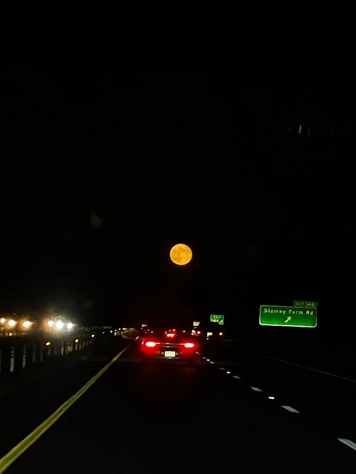
As I drove back home, the massive moon rising from the horizon painted a poetic end to the journey. Reflecting on this solo adventure, I realized that the experiences and encounters with fellow travelers added richness to the trip. Although I embarked on this journey alone, the connections made along the way, the moments of self-reflection amid nature's grandeur, and the unexpected turns made it all the more worthwhile. Traveling solo isn't just about being alone; it's about discovering the profound company within oneself and the world around. Until the next adventure, this trip will remain etched in my memory as a journey of self-discovery, scenic wonders, and the beautiful unpredictability of travel.
As the journey through the Great Smoky Mountains comes to an end, I invite you to be part of the ongoing adventure. Subscribe to Ryan Van Canton for more travel tales and tips.
Hungry for more? Dive into the delectable side of my Great Smoky Mountains adventure by checking out this blog post featuring the scrumptious foods I indulged in along the way.
Your feedback is invaluable, so don't hesitate to leave a comment below. Share your own tips and tricks for exploring this region or suggest the next destination you'd like to see unravel on the blog. Let's build a community of fellow explorers, sharing the wonders of travel, one story at a time. Subscribe, comment, and let's continue this exciting journey together! 🌍✨